
by IGIS Team | Jun 9, 2022 | mapbytes
Earth observation (EO) has become a vital part of analyzing real-time mapping data and visualizing changes that are impacting our world. EO research has evolved in the last few decades due to the increase of commercial and publicly owned satelites. According to the...
by IGIS Team | Mar 31, 2021 | mapbytes
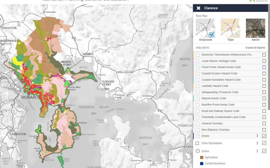
Insight GIS has completed a number of online interactive maps for draft Local Provisions Schedules for the new Tasmanian Planning Scheme. So far, 11 Tasmanian councils are represented. You can view the online maps here.

by IGIS Team | Dec 18, 2018 | mapbytes
Insight GIS has won the award for Spatial Enablement at the 2018 Tasmanian Spatial Excellence Awards. The award was for the MAST GIS application which was developed with Marine and Safety Tasmania (MAST). This award recognises projects in which the application of...

by IGIS Team | Dec 18, 2018 | mapbytes
Insight GIS has recently spoken at Pitney Bowes’ Partner Conferences in Ho Chi Min City and Rome. The conferences are hosted by the Pitney Bowes executive and attended by many of their major business partners in location intelligence and GIS. Insight GIS’ managing...
by IGIS Team | Mar 10, 2018 | mapbytes
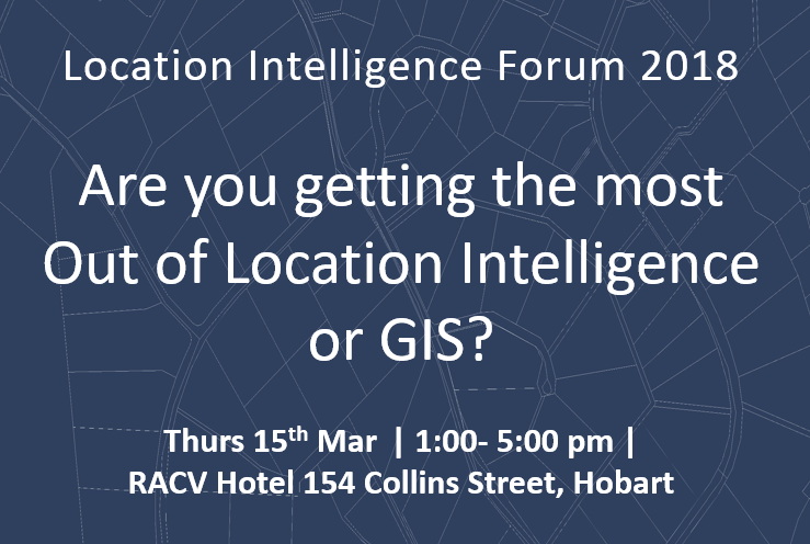
Are you getting the most out of Location Intelligence or GIS? A forum for Location Intelligence and GIS is being run by Insight GIS and Pitney Bowes at the RACV Hotel in Hobart on Thursday 15th March. Go to the website
by IGIS Team | Nov 13, 2017 | mapbytes
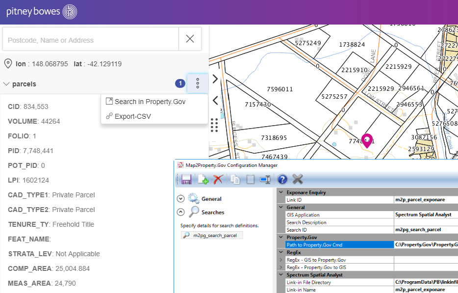
You can now connect your GIS to the Open Office Property.Gov property information management system. Our new integration software Map2Property. Gov provides the capability to run bidirectional search between your the MapInfo GIS suite and Open Office Property.Gov:...