
Spectrum Spatial
The zero footprint Spectrum Spatial enables users to access to your geographic-based information from their browser from anywhere, at anytime. Your users can visualize and analyze GIS information in a web map interface to support their decision making process.
Insight GIS configures Spectrum Spatial to suit your specific needs, and we can ensure that users require little training or skills to utilise it. We have designed effective solutions and implemented Spectrum Spatial for a number of Tasmanian local governments to assist with their GIS needs.
Insight GIS has also developed integration links which seamlessly connect Spectrum Spatial to other third party applications. Existing links that are available include Map2RM, Map2PropertyWise, and Map2Property.Gov.
Features
- Present your GIS information within a web mapping application
- Search and query GIS information
- Capture new spatial information and edit the existing information
- Print maps
Screenshots
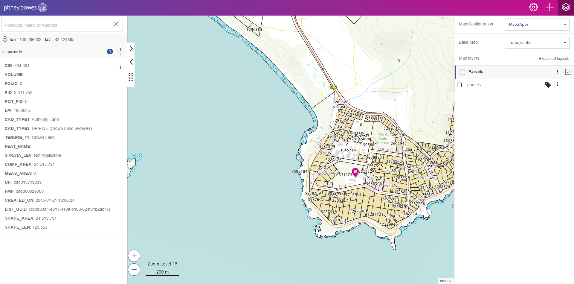
Display GIS information
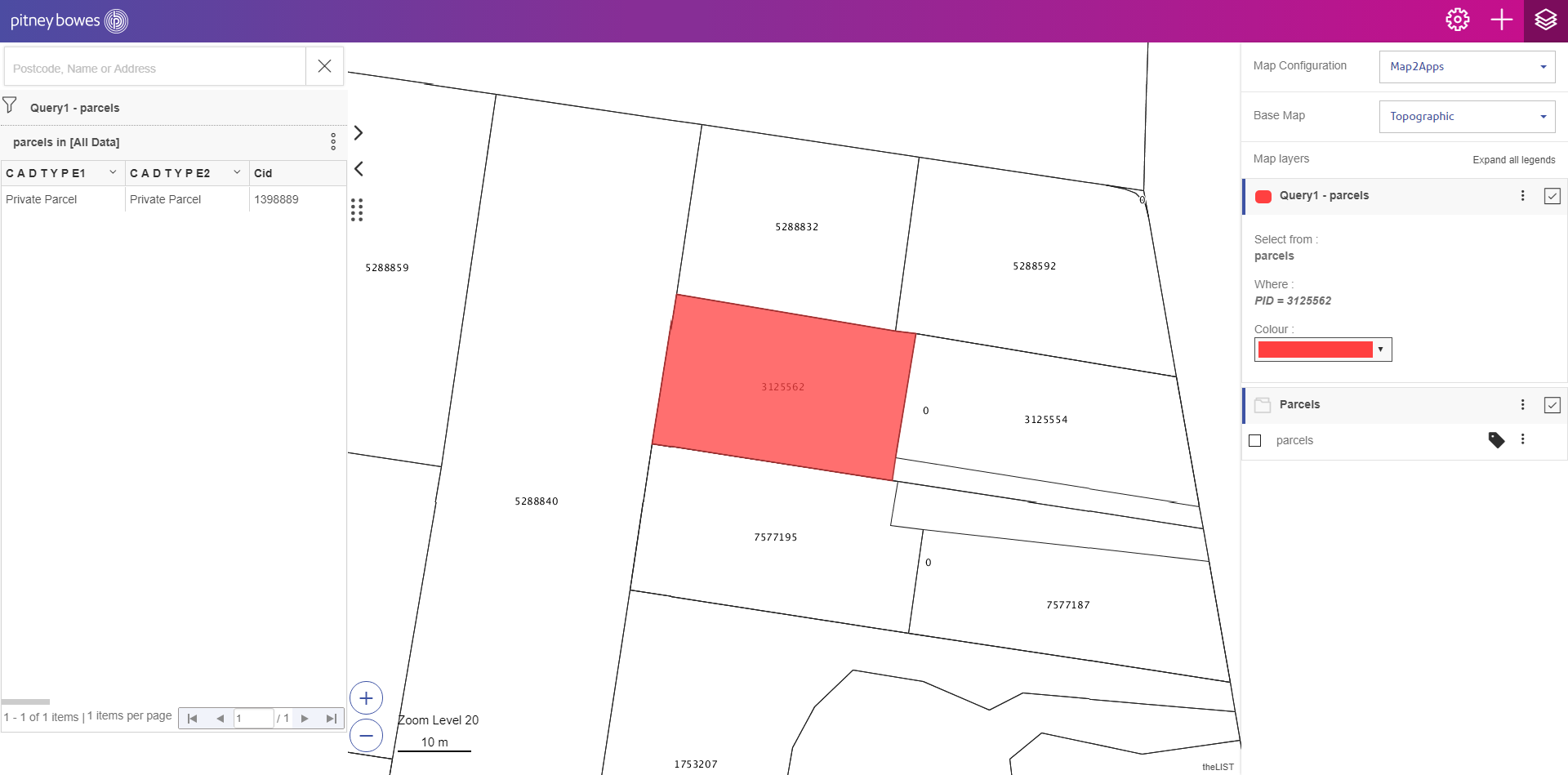
Query GIS records
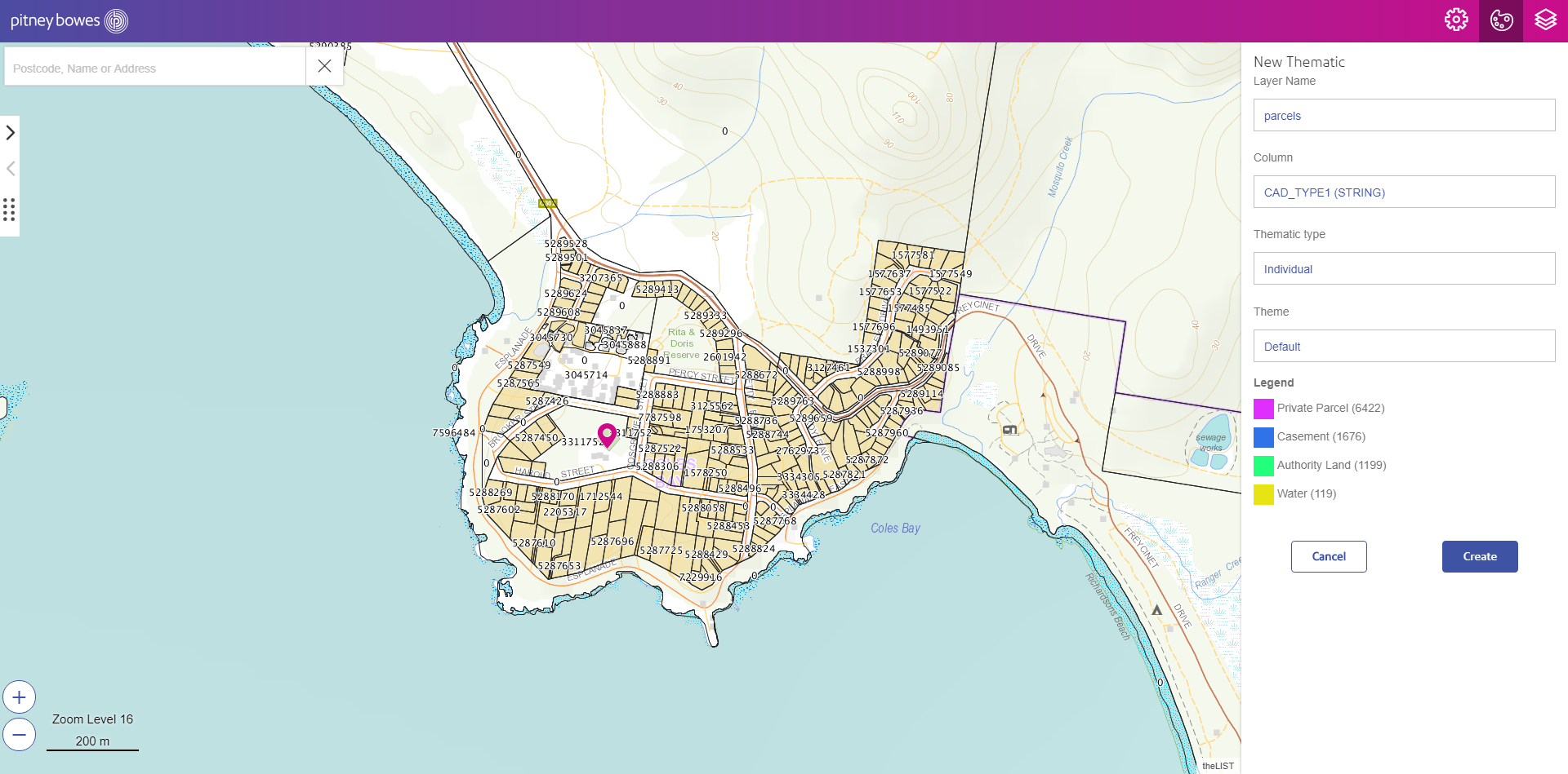
Analyze your data – Thematic map 1

Analyze your data – Thematic map 2

Analyze your data – Heatmap

Analyze your data – Cluster map

Overlay user GIS data

Map printing

Link to third party application
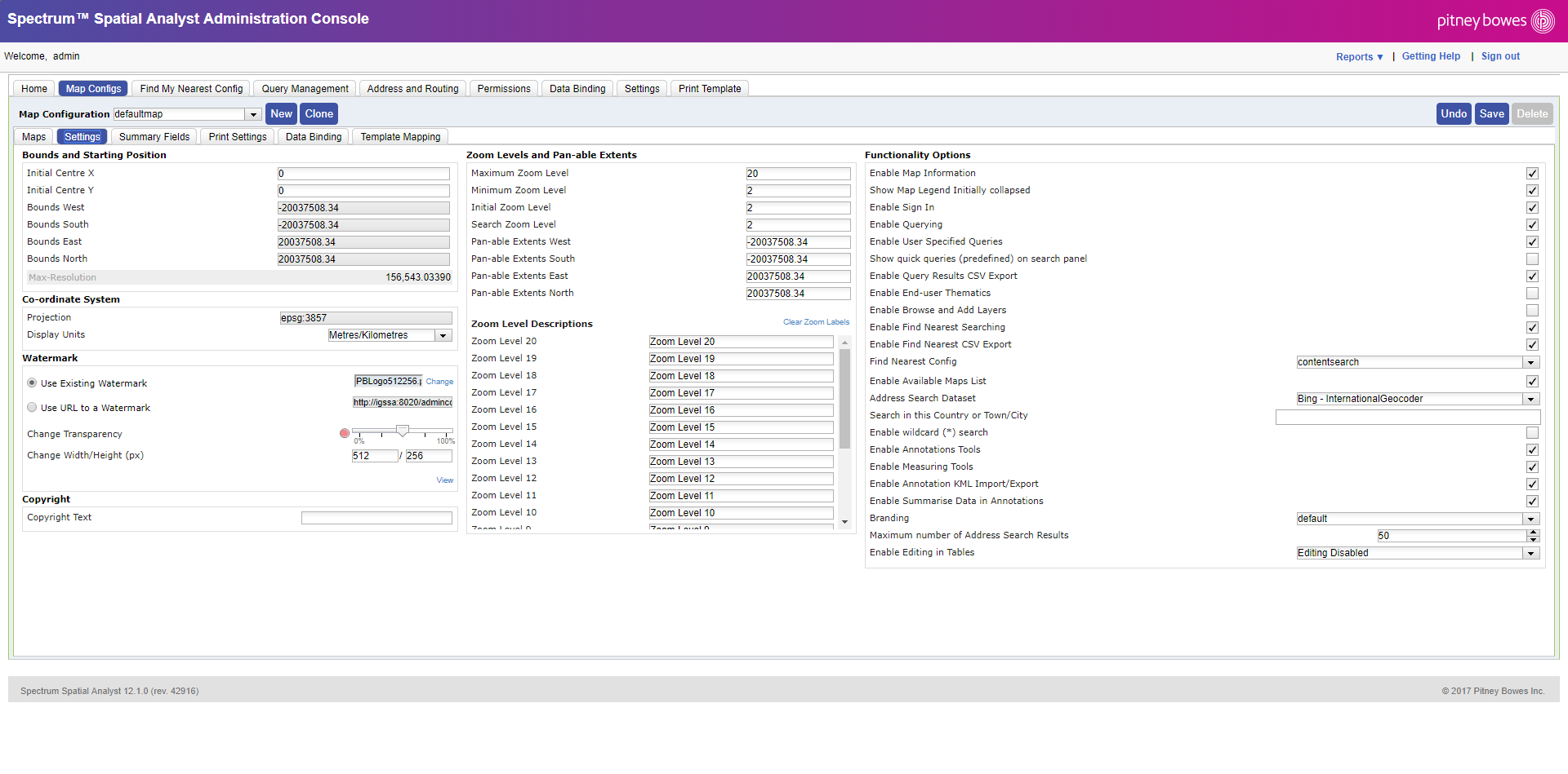
Admin console
Contact Us
Enquire now to find out more information about Spectrum Spatial.
Error: Contact form not found.
Our mission
At Insight GIS we are focused on you, the customer. To maximise the benefits to you we must thoroughly understand your needs and fears. A healthy and effective business relationship can then be built, with a very high probability of success. After 20 years this approach has organically become our core value.
Contact Us
2 Gregory Street
Sandy Bay, Tas 7005
+ 61 3 6234 5833
+ 61 3 6234 5899
info@insightgis.com.au
Sitemap
Home / Services / Solutions / About / Contact Us
![]()